$950,000
$987,600
3.8%For more information regarding the value of a property, please contact us for a free consultation.
285.6 Acres Lot
SOLD DATE : 05/02/2024
Key Details
Sold Price $950,000
Property Type Vacant Land
Sub Type Agriculture
Listing Status Sold
Purchase Type For Sale
MLS Listing ID 1855716
Sold Date 05/02/24
HOA Y/N No
Annual Tax Amount $270
Lot Size 285.600 Acres
Acres 285.6
Lot Dimensions 0.0x0.0x0.0
Property Description
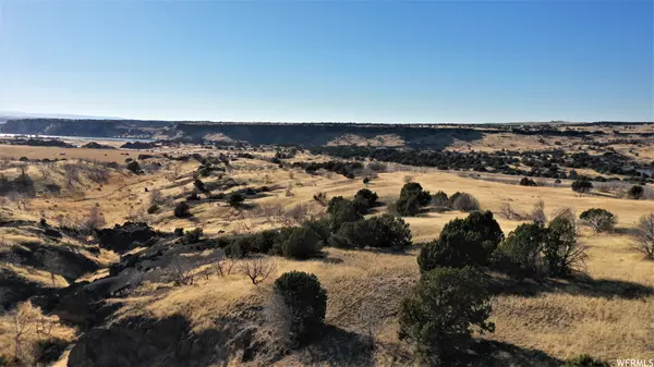
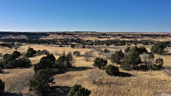
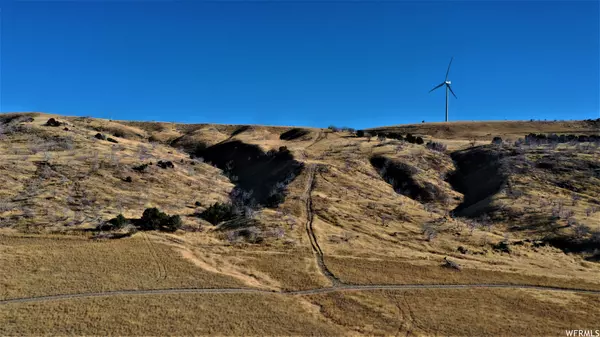
Owners willing to offer seller financing 1.5 miles of frontage on county road Adjacent to Interstate 86 with easy off ramp access Level to gradual slope with draws Panoramic views of Snake River 3 contiguous parcels with potential to further subdivide Two track roads provide access throughout property Overhead power lines along frontage road and onto property 112 acres had been in CRP for 30 years Mostly fenced Hunting Unit 56 with mature mule deer & elk Snake River access & Massacre Rock State Park a mile away for access to boating, fishing & swimming Borders state land Wind farm on adjacent land north and east Conveniently located off Interstate 86 with one and a half miles of frontage on Stock Trail Road, this property is ripe for rural development. Formerly a dry farm, the terrain is level to gradual slope with some draws which allows for panoramic views of the nearby Snake River as well as habitat for wildlife viewing. The property is subdivided into 3 contiguous parcels with a two-track dirt road system providing access throughout. 112 acres had been in CRP for 30 years and just came out of the program this past fall. Private agricultural land borders the property on three sides, limiting hunting pressure and creating habitat for mature mule deer and elk. Snake River and Massacre Rocks State Park access is directly across the interstate and about a mile away, drawing outdoor recreation enthusiasts and history buffs alike. The 990-acre park is a history focused, year-round public recreation area along the Snake River, featuring Massacre Rocks & Register Rock, famous spots along the historic Oregon and California Trail. Geologically, the park was created during the repeated volcanic activity on the Snake River Plain. The rocks themselves were deposited in their present location at the end of the last ice age, during the Bonneville Flood, when much of Lake Bonneville surged down the Snake River. A notch in the cliff on the north bank of the Snake was the site of an ancient waterfall in the aftermath of the flood. This notch can be seen from the property. The park offers historical and geological exhibits in its visitor center, a scenic picnic area surrounding Register Rock, rock climbing routes, a disc golf course, campground and boat docks for day use access to the Snake River for fishing, boating and swimming. Explore miles of trails along the Snake River canyon and preserved sections of the historic Oregon and California Trail hiking, biking and cross-country skiing. Thousands of wagons that passed this point carved the deep ruts that lie before you. From here you can explore the river upstream toward American Falls or head back downstream through the park. Across from the campsites, you'll find Beaver Island and Goat Island. Further downstream toward Register Rock, calm, marshy streams and protected coves offer a variety of fishing spots. In addition to bass, Massacre Rocks is home to rainbow trout, perch, carp, Utah chubs and white sturgeon. There is abundant high desert wildlife, including: Canada geese, grebes, bald eagles, pelicans, blue herons, coyote, muskrat, beaver, cottontail and jack rabbit. Additional nearby attractions include American Falls Reservoir and historic hydroelectric dam, Minidoka Falls, Minidoka National Wildlife Refuge, Rupert Country Club golf course, Rupert Historic District, Minidoka County Historical Museum
Location
State ID
County Power
Area Power
Direction Stock Trail Road
Interior
Fireplace false
Exterior
View Y/N No
Present Use Agricultural
Private Pool false
Building
Faces North
New Construction No
Schools
Elementary Schools Hillcrest
Middle Schools William Thomas
High Schools American Falls
School District American Falls Joint
Others
Senior Community No
Tax ID RPD123500
Acceptable Financing Seller Finance
Horse Property No
Listing Terms Seller Finance
Financing Cash
Read Less Info
Want to know what your home might be worth? Contact us for a FREE valuation!

Our team is ready to help you sell your home for the highest possible price ASAP
Bought with Whitetail Properties Real Estate LLC


